Overview
Detailed below are options for up to three days and 146km of riding linking the resort town/port of Tavira with the village of Alcoutim in the Guadiana valley and Vila Real de Santo António (VRSA) near the mouth of the river.
Some parts of the route overlap – following the river to Alcoutim and back, and between Castro Marim to VRSA.
It would be simple to leave these parts out, creating a 92km circuit linking Tavira and Castro Marim (see below for more details). Alternatively, riding from Tavira through the hills and then down to Castro Marim to catch the train back would be a route of about 66km.

Distance & difficulty
There are three sections to this route (see below), with a total distance of around 146km (91 miles).
Overall, there’s also nearly 1,900m of climbing to do – nearly half of which is on the first section. Road surfaces are generally okay but there are some rough sections, particularly on some of the back roads around Tavira.
- Section One – Tavira to Alcoutim: distance 64km, moderate to tough. No major roads involved but around 920m of climbing. The first seven km out of Tavira are easy but the route then climbs fairly steadily for the next 14km, followed by around 18km of undulating terrain (including one sharp descent and an ascent that hits a gradient of 15%) before dropping all the way to the Guadiana valley. There’s one other reasonable hill (60m) on the way upriver.
- Section Two – Alcoutim to VRSA: distance 44km, moderate. Coming south, there’s the same hill on the valley road about seven km south of Alcoutim, followed by a climb of about 120m back up to the N122, which at one point hits a gradient of just over 16%. From here the route is quite undulating heading towards Castro Marim but gradually losing height. The final section to VRSA is on a busier (and less attractive) road but traffic is not normally so heavy as to cause any real hazard.
- Section Three – VRSA to Tavira: distance 38km, moderate. This section would be easy except for nearly four km of climbing midway, involving about 90m of ascent with a gradient of just over 10% on the steepest section. There’s a very short section (400m) on the N125 coming into Tavira, which has only a narrow shoulder. However, coming in from further east involves equally busy roads and a notoriously dangerous railway crossing – the rails are at a nasty angle and many riders have crashed after getting their wheels stuck.

Click on the map for further details or to download route
As mentioned above, it is possible to leave out the sections going up to Alcoutim and to VRSA. This would give a circuit with a total distance of about 92km (57 miles) and a total ascent of 1,260m. For details of this route, click on this link.
Facilities
You’ll find plenty of cafes, shops etc in Tavira, VRSA and Castro Marim (there’s a Lidl right next to the station in Tavira). Alcoutim has a small mini-mercado and quite a few cafes and restaurants, although not all will be open at night out of season.
Along the ride there aren’t any cafes between Tavira and Foz do Odeleite in the Guadiana valley, and none between Castro Marim and Tavira on the return route until Santa Rita.
If you want to split the ride, then there’s plenty of accommodation in and around Tavira and VRSA, plus more limited options in Alcoutim (including a good youth hostel) and Castro Marim.
Click on Listings to search for accommodation, bike hire, weather forecasts etc…
Detailed Description
The ride is shown as starting and ending at the railway station in Tavira, although VRSA (or Castro Marim) would also be a logical start/finish point.
It’s worth knowing that the railway line running from Lagos to the Spanish border carries bikes for free, making the stations convenient places for setting off on your bike wherever you’re based. (Although the Castro Marim station is some distance from town and in the middle of nowhere!)
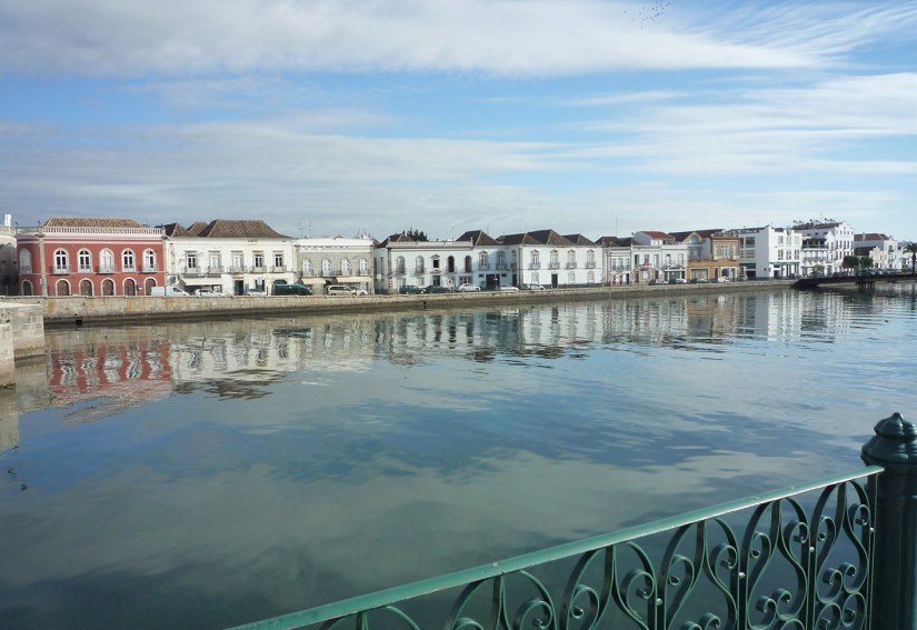
The centre of Tavira is definitely worth a visit – although watch out for cobbles and a complicated one-way system.
Leaving the town centre you’re soon out on a quiet, almost level road following the Rio Gilão. After crossing over to the other bank, head back on yourself for a bit and turn east following a fairly gentle rural route.
Not long after crossing the A22 motorway, the road starts to climb steadily. Most of the hillsides are fairly wild, although dotted with all kinds of villas, of varying degrees of architectural merit. Once you go over the first major line of hills and lose sight of the coast the villas seem to disappear and the occasional hamlets and isolated settlements are more ramshackle and traditional.
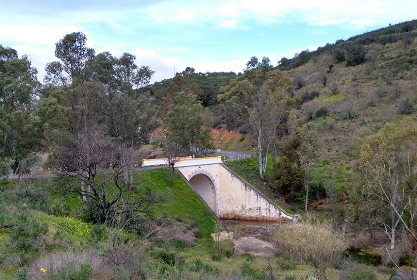
The scenery gradually gets prettier and wilder as you head up to a place called Corte do Gago, which is followed by a steep drop to a valley at the head of the Beliche reservoir – followed by a nasty climb back up the other side.
Once you reach the M512 at the top, however, the ride gets a lot easier and from here its generally downhill to the N122 and then the turning on to the M1063 towards Foz de Odeleite and the Guadiana valley. (Note: If you’re not going to Alcoutim, simply stay on the N122 towards Azinhal.)
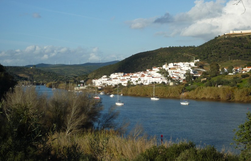
After the long descent to the river, the ride up the Guadiana valley is a breeze – apart from one good climb where there’s a tight bend in the river and the road goes up and over a hill. The route up the valley is also very pretty with gorgeous views of the hills on both the Portuguese and Spanish sides.
Alcoutim is as far as the river road goes and is a charming little village that sits opposite its Spanish counterpart, Sanlúcar de Guadiana. There’s a small passenger ferry that links the villages but it’s not big enough to take bikes. (There’s also a zip wire crossing the river that starts from a hill near the fort on the Spanish side!)
Heading south again, it’s a stiff climb back up from the Guadiana valley to the N122 and the road is quite undulating as it continues south. It’s a quiet route, though, and very pretty, with great views of the hill country in this area. Azinhal marks the last noticeable high point (and has a couple of welcome cafes.)
Back roads through the villages of Monte Francisco and Vista Real provide an opportunity to avoid the IC27 and a busier section of the N122 going into Castro Marim. If you’re in a hurry, although these are more major roads, there’s not generally a lot of traffic on them and they are quite safe to ride, with a reasonable shoulder.
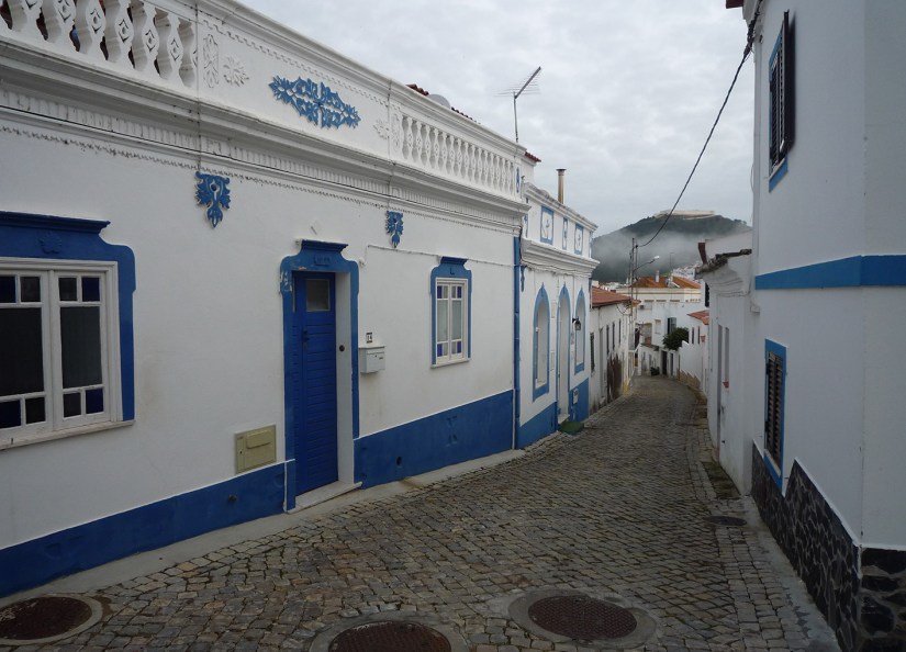
Castro Marim is one of the Algarve’s oldest settlements, with remains from paleolithic, Roman and various other eras. There are some attractive old buildings in the cobbled streets below the castle, which is also well worth a look and entry is only €1.20. The N122 is the only real option to get from Castro Marim to VRSA (it’s possible to take a wider loop around and come in on the N125 but this is even less attractive). VRSA has a lovely old centre, and you can also take bikes on the passenger ferry from here to Ayamonte in Spain.
Heading back to Tavira the route returns through Castro Marim, going out on the N125-6. About 1.5km from town you come to a roundabout and go straight ahead on the M1132-1, signposted to Rio Seco. This part of the ride gets progressively prettier and more rural as you head west, climbing very gently for about the first eight km.
The one big climb of this section takes you up out of the valley, emerging next to a huge golf complex, which comes as a bit of a shock after all the wild, rural views on the way up the hill. From the top it’s a gradual downhill across the A22 to the village of Santa Rita, after which you turn right to head towards Tavira.
This last part is all quite rural. Road surfaces are a bit rough in places but you’re unlikely to meet much traffic. There’s a dogleg as you cross a small river not far from Tavira and the route then takes you around the town to come back in from the north, so as to avoid the busier roads and the dangerous railway crossing on the eastern side.
Route ridden by Huw and Carolyn Thomas, January 2016. Bikes supplied by Cycle Rentals.